Wednesday, March 30, 2022

The Land Bridge

      The following figure is a copy of the earliest map I could find of Britain and Wales.  It is a copy taken from the cover of Gerald of Wales The Journey Through Wales and The Description of Wales, translated by Lewis Thorpe, and published by Penguin Classics in 1978. The original map is identified as being from the 13th-century. It is reported to be located in the British Library, London. [Cott.Claud.D.VI Folio 12v] The land bridge between the Dee (to the north) and the Severn (to the south) as it was drawn a long time ago is clearly shown. It is this land bridge that my Celtic ancestors managed to settle long, long, before this map was being drawn.


      Now place the maps from previous posts using your fine tuned mental images, and judge where Wat's dike, and the guard hedge would be found. It is also the location that many of my Jones ancestors spent their days.

Monday, March 28, 2022

By The Way

      The following map (not another 😕) is taken from a guide book by Reader's Digest, and pieces together two pages. [Guide To Touring Britain, The Reader's Digest Limited, London, 1992, p.159 and p.161] It shows the major locations that Wat's Dyke passes through (orange color) in parallel to the much more famous (and to the Welsh infamous) Offa's Dyke. (in pink color) It would seem that Wat's Dyke guards the lowland from the highland. Offa's Dyke guards the highlands from the highlands. Both come closest together around the area of Chirk Castle, which is near the land bridge that joins the lowlands to the highlands. Wat's Dyke ends just past the land bridge, but Offs'd Dyke continues to the south coast of Wales.


      Now look over the landmarks and various geographic locations. By now you should be able to recognize the general shape and position of the many landmarks. Put these images in the memory bank, and look again at a previous map which shows the general location of the Celtic tribes identified by the Romans starting 55 B.C.


       In your mind try placing the land bridge on the maps above and estimate how strategic the area around Old Oswestry would be during sheep shearing time.  

Sunday, March 27, 2022

Along The Way

      All maps are not created equal. From last post, the following is a repeat of the map that shows Old Oswestry hillfort with Wat's dyke heading north. It is colored orange, heading about 20 degree NNW out of the lowest contact with the fort. It is coming from ground level. [streetmap.co.uk 2007]


      The following map tries to follow this dike along its entire path northward. It is my drawing placed on a survey map drawn 1583 by Saxton described as "The first modern topographical survey of England and Wales...". [copy is taken from Saxton's Survey of England and Wales With a facsimile of Saxton's wall-map of 1583, by R.A. Skelton, 1974, marked X]. The dyke, also drawn in orange, begins at Oswestry heading north, passing through suburbs of Wrexham, and ending at Basingwerk Abby although this location is not shown on this map. It (the map) shows Holywell, where the dyke enters on the NE side at a site Coed Strand meaning trees/forest/woodland.


      The details of the topography show the relationship of the highlands to the lowlands. The major mountains recognized are colored various ways, clustering groups by certain colors. You can follow the orange line (Wat's Dyke) pretty much separating the highlands from the lowlands along the way.


Wednesday, March 23, 2022

A Guard Ditch

      Of all the things my Celtic ancestors accomplished along the way, they certainly new how to dig ditches and put up fences. From one of the earliest circular farms (Abingdon, p.170, Green) down to the much larger and complex hillfort (Old Oswestry, p.190-193, Williams), they surrounded each with ditches and fences.  Initially, the fences were more like hedges formed by a dense row of branches or shrubs, and intended as a barrier defining the outside from the inside. The fences became more complex and stronger to provide defense against all kinds of beats and bangs, from all sorts of animals, including humans.

      The following drawing shows Old Oswestry and its relationship to one of the more famous dykes. The Anglo-Saxons came to call this Wat's Dyke after their word "wat" meaning guards. [I have not seen this described among the many references to this structure, but the word is from my Hand-Book of Anglo-Saxon and Early English by H.Corson, Henry Holt & Company, 1873, p. 472]


      Now, one can see the dyke (bank and ditch) as they were positioned by the fort colored in orange. The ditch faces the western side with the fence on the eastern side. This would make one think that folks wanted "things" to stay on the western side. All along it seemed a little odd that one would place the dike some 500 feet below the ones above, who were able to throw objects down on your head. Not much in the way to guard if you're at the bottom. It must be to guard against something else?  From this fort, the dyke runs some 65 km to the north. [1 km =.62137 mi. for us on this side of the great pond!] The following figure shows Wat's dyke northward as it leaves the fort.


       The map is modified from www.streetmap.co.uk. Anyway, what's the deal? My theory is yet to come.

Wednesday, March 16, 2022

All The Players

      Showing all the players and their geographic relationship is displayed in the following figure. It is my attempt to demonstrate the general grouping of my Celtic ancestors during this very early time in their history. The tribal players are the Deceangli (Vale of Clwyd and Dee) and, the Cornovii ( Shropshire meadows). The hillforts "Old Oswestry" (the center of my story) and, "The Wrekin" (the center of Cornovii) are given. 


      The last post gives an up-to- date map of the same geographic locations. Locate Old Oswestry on the previous figures to help place these landmarks in the visual stages of the mind. Hopefully, this will help all the players get on the score card of history.

Saturday, March 12, 2022

location, location, location

       Old Oswestry Hillfort has been in its location for thousands of years. Other geographic locations such as the Dee and Severn Rivers are likewise the same. Today, there are many, many new locations that dot the landscape. Thus how do these old places relate to the new places? The following diagram shows the relationship that Old Oswestry has to some of the new places. This figure is modified from multimap.com some years past.


      You can see the location of the hillfort just north of the town Oswestry. The town has its own history regarding the origin of this name. The next map is taken from a visitor's guide titled escape which states on the cover "Our country will captivate you". [Indiania Jones is also on the cover!] (www.oswestry-welshborders.org.uk) On the second page it begins it's story "Where Shropshire meets Wales." ... "Where life on the edge of both Wales and England excites". I would guess my Celtic Ancestors had some of the same thoughts. 


      This is taken from the very last folded page of this guide dated 2005. It is in this area that my Jones ancestors shared some of their corridors of time. Location, location, location.


Thursday, March 10, 2022

Liver Rot

       Herd survival was necessary for human survival during this Celtic period of time. Horses, cattle, and sheep would have been top of the list. Now sheep had a special problem with liver flukes. (Fasciola hepatica) which had to be checked along the way. This parasite inhabits the bile passages of the livers of sheep, cattle, and other grazing animals.  If enough flukes are present, severe damage to the liver results. Sheep may sicken and be judged unfit for future benefit. The following figure is taken from the book titled "introduction to parasitology" by Auther Jones, 1967. On page 139, the following figure is modified to show how sheep may appear after infection.


      In this stage, it would be obvious what sheep of the herd would be infected. Certainly no one watching or grazing the sheep would know the cause and have effective treatment. Just slaughter the sheep with one less to shear. This liver rot must stop.

Tuesday, March 8, 2022

How'd They Do That ?

      Frequently it would pass through my mind to ask the question "How would they do that?" You know all the things that were required to keep one's head above water some thousands of years past. Certainly, it would be no easy task for all involved. Now as to sheep and their shearing. How did they do that?

      Starting with today, the following picture shows some folks carrying out this task.

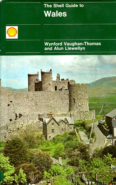
      This photo is taken from another wonderful book titled "The Shell Guide to Wales". It was written by Wynford Vaughan-Thomas and Alun Llewellyn in 1969. This picture by Peter Baker is found on page 96. It certainly looks like the sheep are sunbathing. Each sheep appears 4-5 feet in length, and maybe 1.5-2 feet in width. Put five to six sheep in a row, you might get some idea of the size of the figure (from the Middle Ages) shown last post. 
      Going back in time to the Middle Ages, the following picture shows one tool used to shear. This picture is taken from "Life in The Castle In Medieval England" by John Burke, p.43, first published in 1978. This is the earliest example of a shear I could find. What a tool it is. Can you imagine holding this and your sheep at the same time? Wow, how'd they do that? 

        The Shell guide book was so helpful in understanding some aspects of my Welsh ancestors, I have to show it's cover.


Saturday, March 5, 2022

Keep Counting

     Before the Romans decided to make their way to my Celtic ancestor's hill fort area, the woolen and linen production were well established. Peter Ellis in his book "The Celtic Empire" p.144 states, "At the time Caesar turned his mind to conquest, Britain was a prosperous country with flourishing agricultural communities, advanced in art, woolen and lien production, wheeled pottery and the production of jewellery". [Book Cover shown below]


        On the same page he continues, "It is especially surprising that Caesar seems ignorant of the fact that the woolen cloaks (sagi) from Britain were highly prized in the Rome of his day and were therefore indicative of a widespread knowledge of the high standard of the British woolen industry." (p. 144-145.) Who would have thought of such a thing existing 100 B.C.?

      So to continue counting, William's in is hillfort book (listed on many past posts) p. 192 suggest that between 200 - 300 folks were possibly residing at Old Oswestry around this time. Divide this population by 2 [50-50 male to female ratio taking the lower estimate] It would leave around 50 male souls. Now using the best guess from last post [30 sheep on average per individual/assumed to be head of family] would come to 1500 sheep grazing about. It is documented that shearing occurred in June each year, thus giving roughly 26 days to accomplish shearing the wool, washing and drying, and laboriously beating and combing(called carding), making sacks to carry to market, and keep track of all the happenings. [26 days less 4 Sundays for Church and rest]! Who kept up with all the sheep?

      Now continue counting. If there were 1500 sheep divided by 26 days, it would mean 57-58 sheep per day would have to be handled.  Revisiting a past figure drawn from the middle ages : 6-7 sheep are counted per row for the three rows given to the single shearer. Three additional folks (female) appear to be participating in this activity. Thus in one rectangular enclosure there are 18-20 sheep in one representative drawing. A day's work indeed! 


       Considering Old Oswestry's rectangular structures as shown before: there are six shown to be present on the western facing front. [ 6 x 20 = 60 ] sheep could be handled per day. Hum, what about those numbers! A good possibility it seems.


Friday, March 4, 2022

By The Numbers

       To estimate the number of sheep that would need to be sheared during the month of June for this Celtic period of time is difficult. Just imagine bringing all the sheep in the hills to one agreed upon location, prep and shear the sheep, clean and care for the wool, bundle the wool in transportable ways, and keep track of who belongs to what! The book by Spufford (cover shown below) brings to life the wool trade for medieval Europe many years after the Celtic period. 

      On page 327 he states that "The quantity of English wool exports reached over 45,000 sacks in the single year 1305."  By his numbers, he gives that each sack contained the wool of between 180 and 250 sheep. Thus, 45,000 sacks of wool counted for 8,000,000 to 11,000,000 sheep! That is millions of sheep.

      Likewise, in their wonderfully written book, the Giles report "At Bowerchalk in Wiltshire, twenty-three are known to have owned 885 sheep, or 41 per owner;...". In the same sentence they continue "...: at Merton, eighty-five tenants owned 2,563 sheep, and one is known to have owned 158." This would equal 30 sheep per person. [ 2,563/85] The cover of their book is shown below.

      Taking the estimation of the number of sheep back to our Celtic years becomes more uncertain.  My favorite and most trusted text by Green [The Celtic World] in the chapter by Peter Reynolds titled "Rural Life And Farming" p.188, reads: "...it is important to remember that a decade in farming, like a week in politics, is a long time, certainly long enough to see shifts in a farm's livestock holding - whether by choice or by external constraints, like disease or extreme climate conditions or a combination of both." Wow, how true it was, and it is today! A few more posts to come by the numbers..